Studying Soil from a New Perspective in the Great Plains

The study of soil moisture—defined as the amount of water held between soil particles—can be important for improving agricultural productivity, predicting floods and droughts, understanding Earth’s weather and climate, and more. The amount of moisture in topsoil depends on land surface characteristics (e.g., soil texture) and recent weather conditions, like rainfall. Several prior studies have suggested that small-scale soil moisture patterns—those spanning roughly 3–30 meters—are influenced mainly by land surface characteristics. Large-scale patterns—spanning from 1.5 kilometers to hundreds of kilometers—are influenced mainly by weather conditions.
However, a new study by Dong and Ochsner shows that these relationships are a bit more complex. Past soil moisture studies have been limited by the area of land sensed by their measurement devices, as well as by the average and maximum distances between measurements. Traditional sensors installed in the soil excel at small-scale data collection, whereas satellite-based sensors are powerful tools for observing large-scale soil moisture patterns, but there are major gaps in data and understanding at the mesoscale—between about one kilometer and 100 kilometers.
The researchers applied the cosmic ray neutron method using a mobile neutron sensor called a “rover” to detect fast-moving neutrons just above the ground—neutrons generated when cosmic rays interact with the atmosphere and Earth’s surface. These fast neutrons can be slowed by collisions with hydrogen molecules in the water held by moist soil; the neutrons penetrate anywhere between 15 and 55 centimeters deep. This way, researchers can determine soil moisture of the surrounding landscape on the basis of the number of fast neutrons measured by the rover.
To determine the scale at which soil moisture is most affected by soil texture (as opposed to by rainfall), the researchers deployed the rover along 150 kilometers of unpaved public roads in the Great Plains, where soil ranges from sand to clay. Over roughly a year, the rover collected data on soil moisture patterns at the mesoscale a total of 18 times. The researchers also compiled radar-based rainfall data along the rover path. In all but one instance, they found that soil moisture patterns were more closely tied to variations in sand content than to variations in rainfall.
This study offers a unique, detailed set of soil moisture data. It also shows that although the drivers of soil moisture at the mesoscale varied, it was generally more affected by soil texture than by rainfall. These findings have the potential to refine conceptual models about spatial patterns in soil moisture and to improve future studies in soil science, hydrology, and other fields. (Water Resources Research, https://doi.org/10.1002/2017WR021692, 2018)
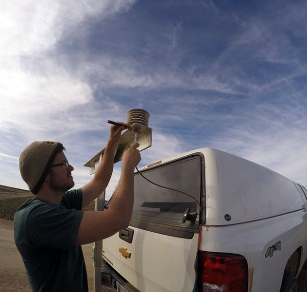
Pictured: Former Oklahoma State University undergraduate research assistant Phillip Pope prepares the rover used to collect soil moisture data. Photo credit: Jingnuo Dong.
___________
Story reprinted from: Earth & Space Science News, https://eos.org/research-spotlights/studying-soil-from-a-new-perspective, Authored by Sara Witman, June 18, 2018.
Witman, S. (2018), Studying soil from a new perspective, Eos, 99, https://doi.org/10.1029/2018EO098529. Published on 18 June 2018.
